UN and Philippines using drones to help farmers tackle climate disasters
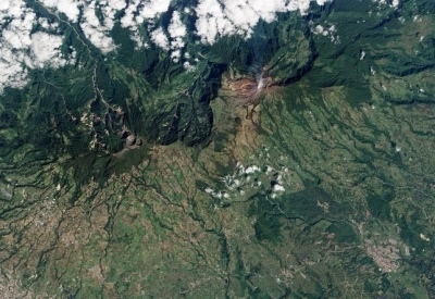
The Philippines and the Food and Agriculture Organization of the United Nations (FAO) are using unmanned drones to assess the risk of natural disasters to the country’s farmlands.
Two drones have already been deployed as part of the project to assess the current El Niño conditions.
Jose Luiz Fernandez, FAO representative in the Philippines, said:
“Imagery generated from drone flights can reveal where agricultural infrastructure projects and service facilities like irrigation or storage facilities could be sited to best serve local farmers. The technology can also potentially support in the assessment of coastal and forest areas.”
About 25 technical experts from the FAO and the Philippines government will be deployed across the country to support the mission having been trained over three weeks on how to control the drones.
The drones have navigation and photogrammetric equipment to generate maps from aerial photographs.
The data will be used to assess where agricultural systems are most vulnerable to natural disasters and help identify effective ways to reduce risk including ground contouring, building retaining walls and planting protective vegetation.
The drones will cover up to 600 hectares a day, according to Christopher Morales, director of field operations for the Philippines’ department of agriculture: “It is efficient, it saves time and we will be using a reliable source of data so that we can plan and provide appropriate interventions and responses for our farmers in times of disasters and calamities,” he says.
Article Source: Climate Action
Recommended
-

-

AIDF are pleased to open nominations for the Africa Innovator of the Year Award 2019!
-

Just three countries support over 50% of the World’s refugees
-

-

-

UN report warns Asia-Pacific is falling behind Zero Hunger targets, as millions remain malnourished
-

WHO’s ‘World Malaria Report’ warns that global progress in eliminating the disease is stalling
-

Approximately 821 million people in 2017 suffered from hunger, according to new report
-

Every country in the world is falling short of malnutrition targets, warns new report
Subscribe To Our Newsletter
Subscribe